What is the cost of erosion to your farm?
The loss of fertile topsoil, its nutrients, and a reduction in depth to subsoil can incur significant costs to farm productivity that haven’t traditionally been accounted for and don't appear on balance sheets. The erosion economic calculator was developed to support the hillslope erosion work undertaken by NRM North, and is now offered as a resource for the broader agricultural community to understand the financial risks of erosion on cropping land.
About the Calculator
About the Calculator
The Erosion Economic Calculator has been developed to enable members of the agricultural community to understand the financial risks of erosion, and the potential costs of inaction.
The online calculator estimates the cost of;
- lost carbon and nutrients;
- lost future yield potential; and
- the accumulated cost over a 10-year period if mitigation impacts are not in place.
What data does the calculator use?
What data does the calculator use?
The data underpinning the calculator includes:
- a list of bulk densities of common soil types used in Tasmania for agricultural production;
- optimum soil fertility levels for different farm enterprise categories;
- fertiliser needs and costs to achieve those fertility levels; and
- average farm returns per hectare for different farm enterprises.
This data is updated on a yearly basis.
Assumptions and limitations
Assumptions and limitations
Soil fertility
For simplicity, there are only three categories for soil fertility:
- vegetable crop/milking platform (high fertility);
- broadacre crop/improved pasture (medium fertility); and,
- low-input pasture (low fertility).
The calculator assumes that soil fertility is kept at recognised industry ‘optimum’ levels for each category. The latest price is used for fertiliser, but it ignores additional costs involved with fertiliser haulage and spreading.
The calculator results address soil carbon, nitrogen, phosphorus, potassium, and sulphur only. Other lost soil nutrients are not included in the results.
Lost future yield
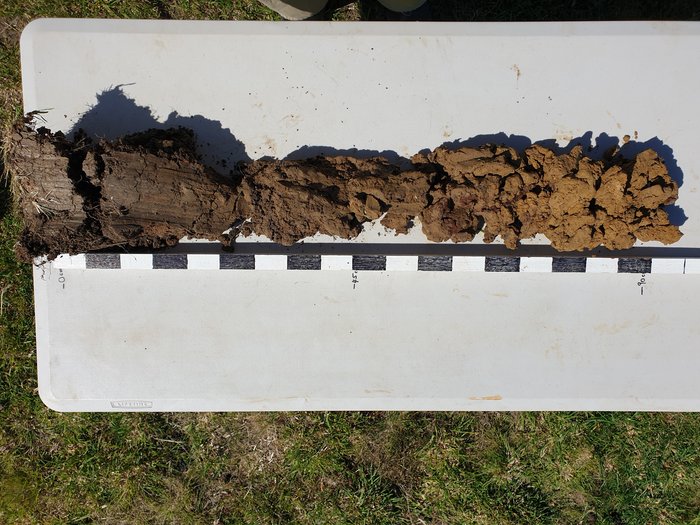
This is a simple calculation based on the reduced volume of topsoil available after erosion and the average yield returns for that broad enterprise category. The more topsoil lost, the less volume of soil per hectare available for holding nutrients and water in spaces easily accessible to plant roots – therefore reduced potential for high agricultural yields due to increased moisture stress, disease risks etc.
The calculator assumes that 30cm of topsoil depth was available prior to erosion. Where topsoil is shallower, the percentage loss due to erosion is likely to be higher.
Depending on soil characteristics and enterprise type, erosion can create additional costs, such as de-stoning operations. As these only occur in certain situations, they were not included in the calculator.
In some cases, soil eroded from production areas can be recovered from dams or roads with completely different costs including degraded soil structure. In these cases, the calculator results do not apply. Off-site costs of erosion such as public costs are not included.
Background
Background
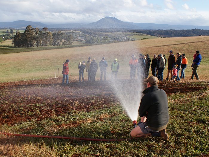
NRM North’s first hillslope erosion trial at Weetah in 2019 included a simple financial analysis of erosion costs by environmental and agricultural consultancy, RMCG. This financial analysis generated interest from the local farming community and NRM North saw benefit in creating a detailed, adaptable all-purpose calculator to understand the potential costs of erosion.
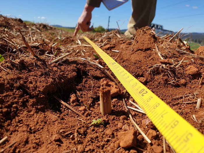
During NRM North’s hillslope erosion trial near Deloraine in 2019, project staff measured the erosion by inserting a grid of narrow bamboo pegs in the soil at the start of the trial in early winter, then measuring by hand the varying height of soil compared to bamboo pegs across the grid in late spring. A total of 190 measured pegs provided reasonably reliable results. This is just one method that can be used to measure erosion; it is inexpensive and accurate, though time-consuming. Other methods may involve flumes to capture soil at the bottom of a paddock, counting the number and extent of rills, or alternatively changes in soil height can be measured relative to a raised, level bar above the soil.
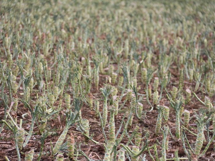
Through our trials we have demonstrated that bare soil, steep slopes and high- and/or intense rainfall can produce much greater losses and subsequently much higher costs to future farm productivity. Establishing and maintaining ground cover can significantly reduce erosion losses, proving to be a prudent mitigation technique.
Mitigation techniques
Mitigation techniques
Erosion mitigation, or control practices involved two components – providing cover for the soil surface and controlling runoff.
Well managed, undisturbed soils are full of beneficial biology that protects them from erosion. The beneficial bacteria and fungi that live within the soil produce natural adhesives that hold it together. Plants in the soil also help by intercepting the rain with their foliage and litter, while their roots help bind it together.
The resources below provide information on our trial sites and findings, managing cropping soils and methods of mitigation.
Acknowledgements
NRM North would like to acknowledge those who contributed to the development of the Erosion Economic Calculator. While Adrian James (NRM North) was the lead developer, others contributed valuable data, knowledge and experience. These include:
- Dr Bill Cotching
- Tasmanian Department of Primary Industries, Parks, Water and Environment
- Lee Menhenett (Incitec Pivot ltd)
- Dr Doris Blaesing (RMCG)
- Frank Mulcahy (Simplot Australia)
- Peter Heading (NRM North)
This project was supported by NRM North, through funding from the Australian Government's National Landcare Program..