Hillslope Erosion Project
The Hillslope Erosion Project aimed to build awareness of hillslope erosion and to increase the adoption of best practice mitigation techniques to minimise future soil erosion. The project concluded in June 2023.
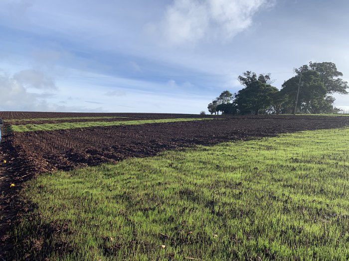
Fodder germination at the current trial site at Jetsonville, Tas.
Focus
Focus
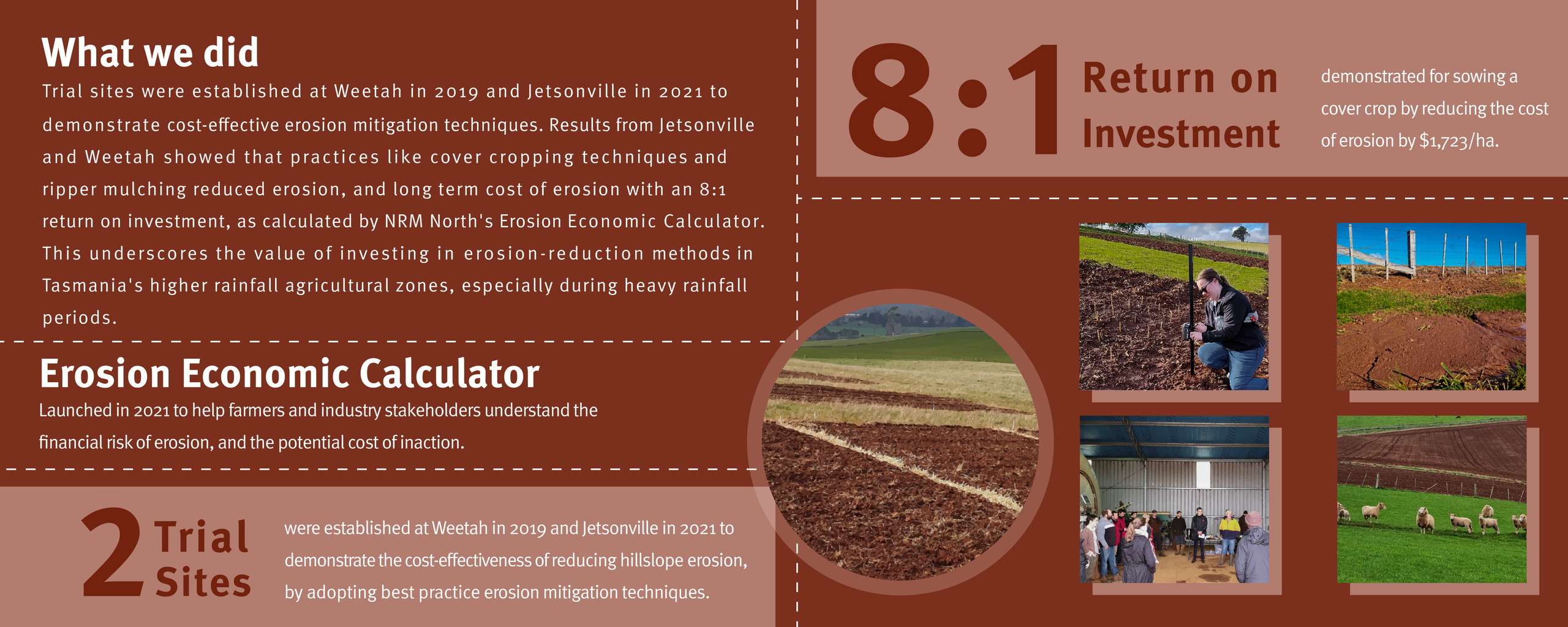
The Hillslope Erosion Project focused on areas in northern Tasmania with intensive cropping enterprises and high susceptibility to hillslope erosion including Deloraine and Scottsdale. Trial sites were established over the duration of the project period to investigate the cost-benefit ratio of different hillslope erosion mitigation techniques.
“Any cover is better than no cover at all. You need to think of these techniques as a form of insurance, because it’s worth your time and the cost involved to protect your most valuable asset.”
Dr Bill Cotching
“Any cover is better than no cover at all. You need to think of these techniques as a form of insurance, because it’s worth your time and the cost involved to protect your most valuable asset.”
“Any cover is better than no cover at all. You need to think of these techniques as a form of insurance, because it’s worth your time and the cost involved to protect your most valuable asset.”
Dr Bill Cotching
Dr Bill Cotching
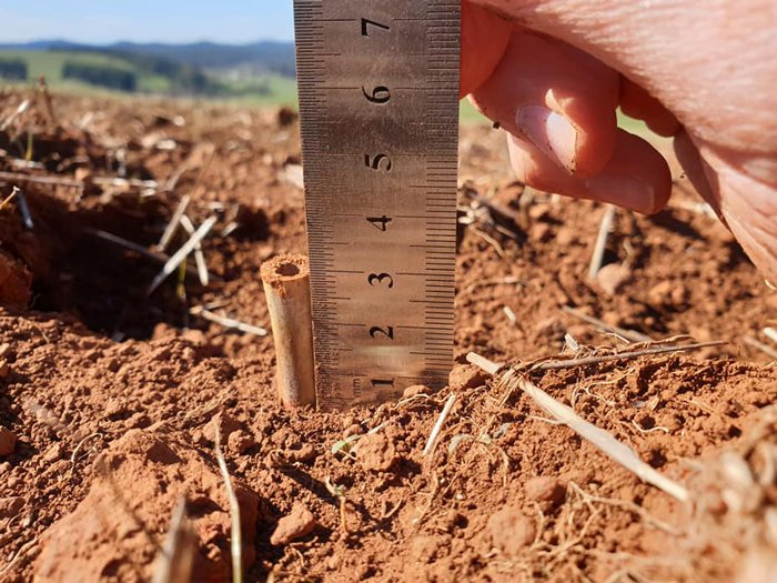
Bamboo pegs measure the deposition or erosion of soil.
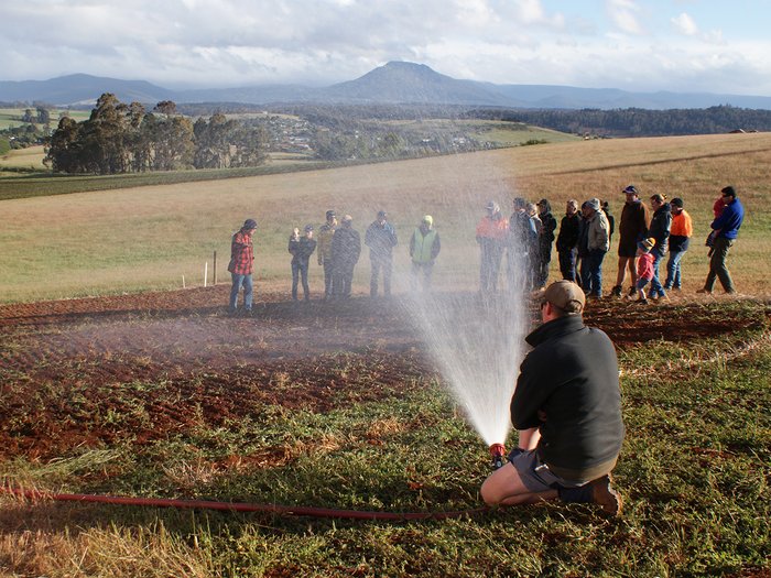
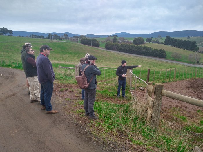
Heavy rainfall was simulated at the end-of-trial field day in Weetah.
Value
Value
Tasmania's most productive vegetable growing areas have long suffered from significant hillslope erosion due to high rainfall, sloping paddocks, and crops that require bare seed beds.
Satellite images show red/brown flumes of soil being washed out to sea from intensive vegetable production areas following intense rainfall, resulting in the loss of some of Tasmania's most nutrient-rich soils.
Achievements
- - - - - - - - - - - - - - - - - - -
Cost-benefit ratio - Case Study 1
Cost-benefit ratio - Case Study 1
To investigate the cost-benefit ratio of different hillslope erosion control methods, NRM North prepared five 250m2 demonstration plots at Moore’s Vegetables, Jetsonville in June 2021. The treatments investigated included: bare fallow (smooth bed); Tama ryegrass cover crop on smooth bed; contour-ripped with Tama ryegrass cover crop; and contour-ripped with Tama ryegrass cover crop (early terminated).
A total of 190 notched bamboo monitoring pegs were inserted into each plot, and the change in soil level was measured on each peg, by hand on 17 November 2021.
Results indicated that on a moderate slope on Scottsdale ferrosols in a wet year and late sowing of cover crop, erosion will occur despite treatments. However, sowing a basic ryegrass cover crop reduced the costs of erosion by $1,723/ha, including the cost of a cover crop.
Spending money on cover crops or tillage, to reduce erosion risk through winter and early spring, is usually a cost-effective investment in Tasmania’s higher-rainfall agricultural zones.
Get involved
There are means and ways to reduce erosion in any circumstance. Even the amount of soil that can move in a dry winter or spring is worth saving. How much soil has been lost from your property in the last 20, 50 or even 100 years?
Erosion Economic Calculator
Erosion Economic Calculator
Erosion Economic Calculator
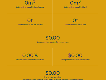
What is the cost of erosion to your farm? Enter your farm’s estimated loss of soil and farm type into the calculator to see how much erosion is costing you.
Resources
Resources
Partners
This project is supported by NRM North, through funding from the Australian Government’s National Landcare Program.
Partners
This project was supported by NRM North, through funding from the Australian Government’s National Landcare Program.