Ringarooma Ramsar Project
The Ringarooma Ramsar Project aimed to protect the ecological character of the Flood Plain Lower Ringarooma River Ramsar site by improving and protecting the condition of the site’s floodplain, wetlands, and swamp forest. The project concluded in June 2023.
Background
Background
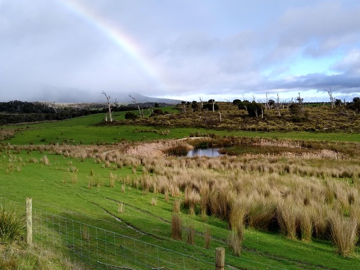
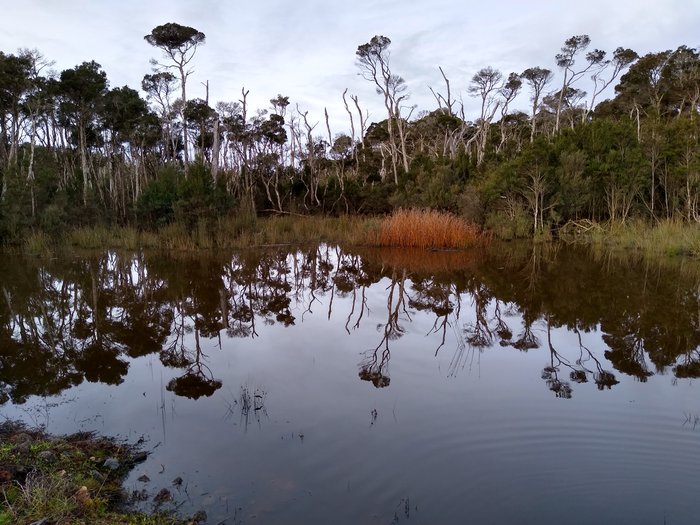
The Flood Plain Lower Ringarooma River wetlands were designated a ‘wetland of international importance’ under the Ramsar Convention in November 1982. The site is a complex wetland, coastal and estuarine ecosystem that provides habitat for important and nationally recognised threatened species. The site includes the Boobyalla Inlet, a mobile sand dune , and incorporates reserves and private agricultural land.
Habitat transforming weeds, particularly gorse, willow, and boxthorn, are a major threat to the dune wetlands and native Melaleuca vegetation. Inappropriate land use in areas immediately adjacent to the wetland, such as stock and vehicle access, cause damage to the wetlands and Melaleuca vegetation, which may create long-term impacts for the Ramsar site.
Water sampling and vegetation surveys have improved our knowledge and formed the foundation for planning the most effective actions to protect this diverse wetland system. Prioritised on-ground land management actions were developed to improve the quality of surface water draining from dairy and grazing operations to the wetlands, and to remove infestations of high-threat environmental weeds from, and immediately adjacent to the site.
Baseline water quality sampling forms the foundation for planning.
'Agricultural land forms part of this internationally listed wetland site, which also encompasses freshwater, estuarine and coastal ecosystems.'
'Agricultural land forms part of this internationally listed wetland site, which also encompasses freshwater, estuarine and coastal ecosystems.'
Achievements
- - - - - - - - - - - - - - - - - - -
Restoring the ecological character of the Ringarooma - Case Study
Restoring the ecological character of the Ringarooma - Case Study
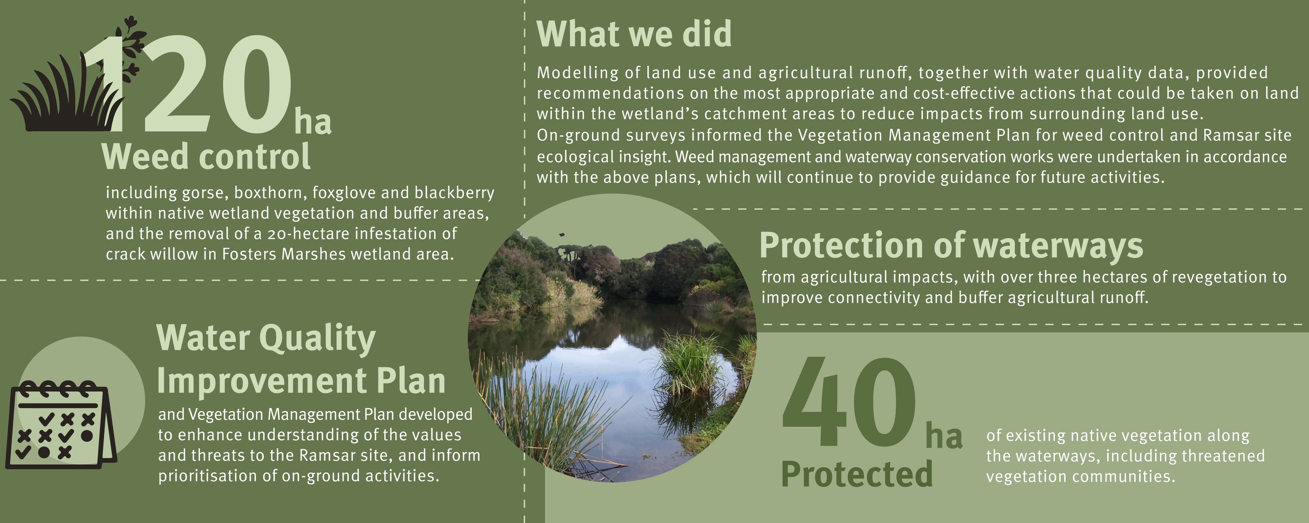
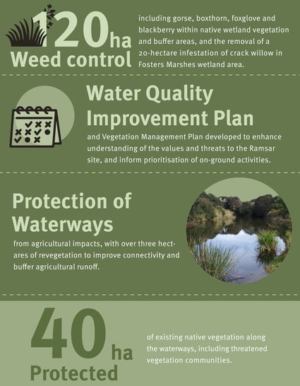
The final year of the project saw the completion of over 120 ha of weed management work within the Ramsar site, addressing gorse, Spanish heath, foxglove, blackberry, and crack willow infestations. The eradication of crack willow from Fosters Marshes was particularly significant, with over 300 willow trees treated among native wetland vegetation. NRM North’s Biodiversity Program Manager Kate Thorn said weed control outcomes were rewarding given the difficulties of working in the area.
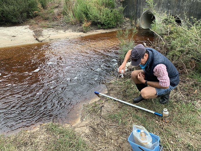
Hardwickes Creek in the Ringarooma Ramsar wetland complex, one of NRM North’s water quality sampling sites.
“The project has been pretty challenging, working in a large and remote wetland area, particularly as we had almost three years of La Nina conditions across the 4-year project.”
“The project has been pretty challenging, working in a large and remote wetland area, particularly as we had almost three years of La Nina conditions across the 4-year project.”
Kate Thorn
Kate Thorn
Recommendations from a Water Quality Improvement Plan developed early in the project included excluding livestock from over 6 kms of waterways to reduce the impact of agricultural runoff to the wetland ecosystems, and over 2,800 seedlings planted to revegetate tributaries to improve buffering of waterways flowing into the Ramsar site from agricultural land.
The Water Quality Improvement Plan and Vegetation Management Plan provide an excellent basis for future planning and management of the site and its catchment.
Partners
This project was supported by NRM North, through funding from the Australian Government's National Landcare Program.

Partners
This project was supported by NRM North, through funding from the Australian Government's National Landcare Program.