Tamar Estuary Management Taskforce Trial Wetland Restoration Project – North Esk
This project aims to restore wetlands in the North Esk River to reduce sediment, improve water quality and habitat for native species, and enhance community amenity by expanding the tidal prism and reducing mudflats.

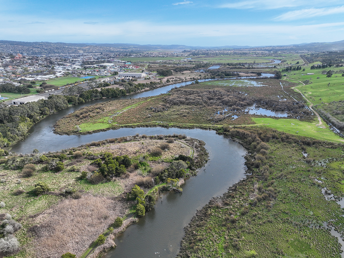
The meandering North Esk River flowing alongside part of the trail wetland site prior to restoration works. The aerial photo shows the floodplain area (on right) where project activities will restore natural ecosystem functions and address threats such as invasive weeds.
Background
Background
The Trial Wetland Restoration Project - North Esk is a key initiative under the Tamar Estuary Management Taskforce’s (TEMT) implementation plan for the 10-year Vision for the Kanamaluka / Tamar estuary.
The project aims to restore the natural connection between tidal floodplains and the North Esk River channel, rehabilitate native habitats, and improve the health of the river system. Through these actions, it seeks to help manage sediment within the river and estuary, enhance water quality and expand aquatic habitat for native species.
The project site lies adjacent to the lower North Esk River between Henry Street and Hoblers Bridge in Launceston. This Crown Land area has been used for agriculture for several decades and has undergone significant modification since European settlement. Informal levee banks, drainage channels, and hardstand tracks now restrict natural flows between the river and its floodplain.
Much of the lower North Esk River and its floodplain form a rare environment known as a tidal freshwater zone. Here, tidal movement from the Kanamaluka / Tamar estuary pushes fresh water back up the river, creating water level variations up to 10 km upstream of the Tamar confluence and regularly inundating the floodplains with predominantly fresh water.
By restoring and improving the ecological functions of the wetland, the project will improve habitat for threatened species and test whether wetland rehabilitation and an increased tidal prism can help reduce sediment accumulation in the upper Kanamaluka/Tamar estuary.
Project Plan
Project Plan
NRM North is a key delivery partner in the Trial Wetland Restoration Project, collaborating with Infrastructure Tasmania to design and deliver the project on behalf of the Tamar Estuary Management Taskforce.
The project is being delivered through several structured phases to ensure a robust, evidence-based approach to restoring this unique wetland. These include:
- In-depth foundational work to establish an Ecosystem Baseline Inventory through field surveys and data, analysis, and preliminary on-ground works such as weed management.
- Undertaking a detailed wetland restoration opinions analysis and outcomes modelling to identify design elements that will maximise project benefits for the available funding.
- Finalising the detailed design and implementation planning and obtaining necessary regulatory approvals.
- Implementing on-ground restoration works.
- Monitoring and evaluating restoration outcomes.
The project is supported by $8 million in funding from the Australian Government's Urban Rivers and Catchments Program, $450,000 in seed funding from the Tasmanian Government, and City of Launceston is providing $300,000 of in-kind support. Completion is expected in June 2028.
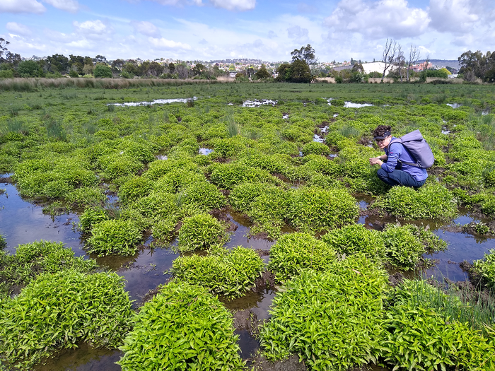
Wetland habitat on site has been significantly altered by agricultural practices including the construction of drainage channels and barriers to natural tidal flow, as well as grazing by domestic stock.
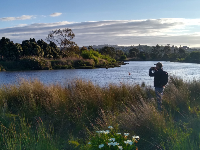
Consultant ecologist Andy Welling undertakes a dusk bird survey at the project site and adjacent North Esk River. Comprehensive baseline data for the site has been compiled to inform project planning and enable assessment of restoration success over time.
Understanding the site
Understanding the site
Initiated in 2024, key work to date has focused on comprehensive planning and the collection of baseline environmental data. Under the guidance of the Project Steering Committee, NRM North commissioned a wide range of surveys to understand the site’s natural values, including assessments of flora and fauna, water quality, topography, and tidal flow patterns.
Regular water monitoring and seasonal surveys have provided insight into the health of aquatic ecosystems and surrounding habitats. Early findings show good bird and bat diversity, while reptile and frog populations are relatively low, highlighting opportunities for ecological improvement. Additional field and desktop studies captured information on native and non-native species, topography and landforms, aquatic health, soil condition, and the site’s resilience to historical and current pressures, including climate change.
With a strong data foundation in place, the next phase focuses on detailed modelling and evaluation of restoration options, leading to a final design for the preferred wetland configuration. Meanwhile, essential groundwork such as invasive weed control and native seed collection for future revegetation has commenced.
Once designs and approvals processes are finalised on-ground restoration works will begin, followed by ongoing monitoring and evaluation to measure the wetland’s ecological recovery and community benefits over time.
“It’s so interesting to see the tidal variation in a freshwater zone. Water quality and aquatic habitat at the project site are quite degraded, but the potential for improvement is there and it will be exciting to see the project progress to the implementation stage.”
“It’s so interesting to see the tidal variation in a freshwater zone. Water quality and aquatic habitat at the project site are quite degraded, but the potential for improvement is there and it will be exciting to see the project progress to the implementation stage.”
Carryn Manicom, Marine Solutions Tasmania
Carryn Manicom, Marine Solutions Tasmania
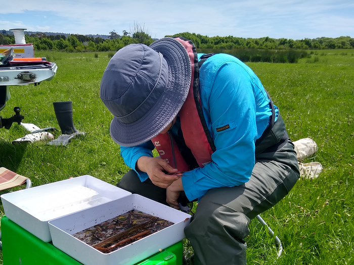
Carryn Manicom from Marine Solutions Tasmania has undertaken monthly water monitoring and seasonal macroinvertebrate (water bug) surveys as part of establishing a comprehensive baseline dataset for the site’s environmental values.
Partners
This project is funded by the Australian Government’s Urban Rivers and Catchments Program, with the support of the Tasmanian Government, and in-kind support from the City of Launceston.

Partners
This project is funded by the Australian Government’s Urban Rivers and Catchments Program, with the support of the Tasmanian Government, and in-kind support from the City of Launceston.